EarthCurrent
The changing world, in one view.
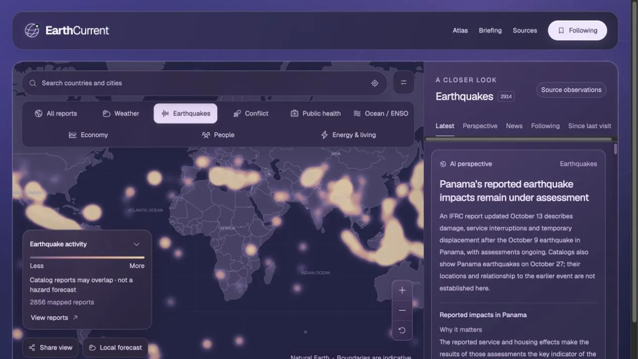
The preview could not load. You can still open the project using its link.
Who it is for.
Curious readers and research teams exploring global developments through geography and original sources.
The problem
Weather, earthquake, conflict and public health reports arrive through separate sources with different reporting periods. Understanding a place means comparing the evidence without mistaking incomplete coverage for certainty.
The response
EarthCurrent connects an interactive world atlas to a developments feed and source-linked AI perspectives. Readers can search a place, change the map layer and follow the original evidence behind a report or briefing.
What the project does.
Follow the useful parts of the experience, from the first decision to the next action.
Capabilities
- Explore weather, earthquakes, conflict, public health and global indicators on a shared map.
- Search countries and cities, filter reports and share a map view.
- Read AI briefings alongside linked sources, observation dates and coverage caveats.
How it works
- Search a place or explore the world overview.
- Choose a map layer and open the related reports.
- Read the perspective and follow its sources to assess the evidence.
What this version demonstrates.
Source coverage and reporting speeds vary. AI perspectives can be incomplete or mistaken; check original sources and dates. EarthCurrent supports understanding and is not an emergency alert service or a hazard forecast.
A similar problem in your business?
Bring your current website, your workflow and what is getting in the way. We can use this project as a concrete starting point.
Discuss your project